
GEOINT: How to find the location of a protest
December 29, 2022 · 3 min read
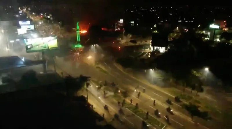
With many ongoing social crises in the world, it has become common to come across videos of protests. However, these can often be hectic and hard to place. Using an example from Bolivia, we are going to show how we can find the location where this type of content is taken.
Thursday 29th December, Luis Fernando Camacho, governor of the Santa Cruz region and opposition leader to the Bolivian government was arrested on ‘terrorism charges’. This development caused a resurgence in the protests that have been ongoing for weeks in the region. Agence France-Presse posted a footage of the demonstration on Twitter : the video shows an aerial view of people running on large boulevards and fireworks being shot from the streets. The description only says it was taken “in the Santa Cruz region” but I’m sure we can be more precise than that.
1. Identifying distinctive features
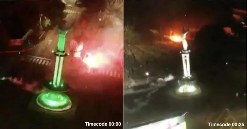
Now let’s get to work. First let’s find the most distinctive feature of this footage. Here it’s pretty easy, we can see a large statue set at the crossing of two boulevards and it is shown at different angles in the video. So all we need to do is to find this statue in the Santa Cruz region.
2. Looking for the city
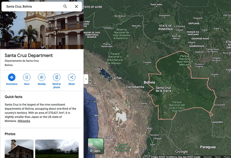
Only problem: the Santa Cruz region is huge. A quick check on Google Maps shows it probably covers a third of Bolivia.
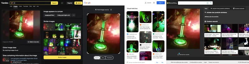
There is also another issue : reverse image searches of the statue are not conclusive. The low resolution of the video added to the fact that it is shot at night make it impossible for the main image search engines to recognize the statue.
But all is not lost! Although the Santa Cruz Region is vast, the city Santa Cruz de la Sierra is one of the only large cities in it, and the video seems to be taken in a large city. Hence, chances are that the video was taken there.
3. Looking for the feature in the city
Let’s have a look at the statues in Santa Cruz de la Sierra then. We can search in Google Maps for “estatua Santa Cruz Bolivia” (thanks Google Translate for the translation to Spanish).
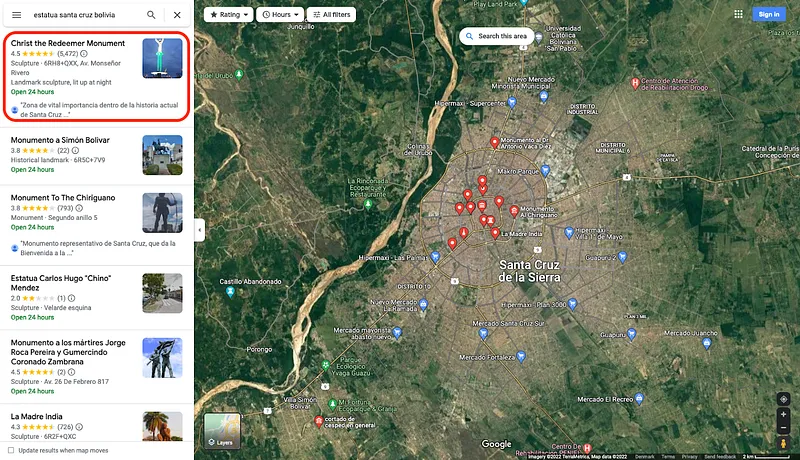
Already the first result seems to be a match. Like in the video, this Christ the Redeemer Monument is located at the crossing of two main streets, and the pictures in the reviews show it has been lit in green light before, again, like the statue in the video.
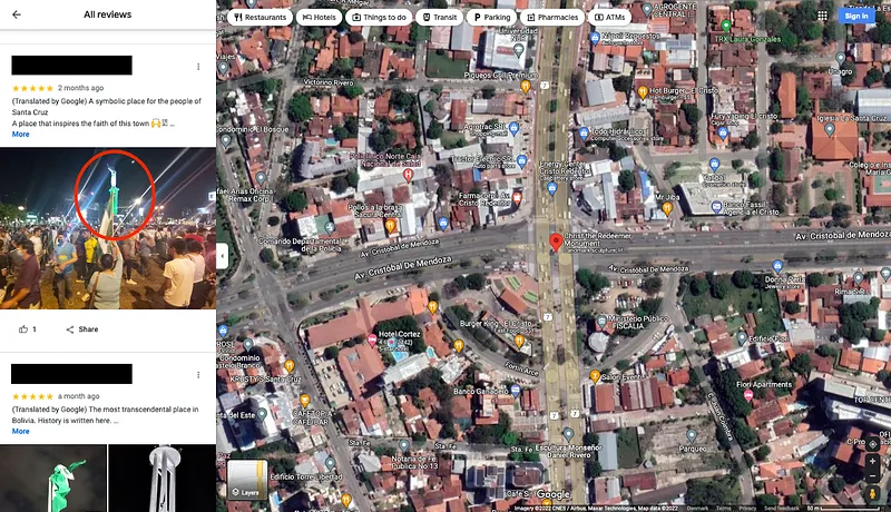
4. Confirming the findings by comparison
We can now look for other distinctive landmarks in the video to check if they match the surroundings of this Christ the Redeemer Monument. To get a clearer image, let’s go to Google Earth.
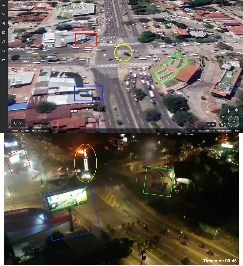
Highlighted in green we see the same two curved patches of plants, highlighted in red and blue there are billboards and their shadows are visible on Google Earth, and all of this is placed around the Christ the Redeemer Monument, highlighted in yellow. Together, these elements confirm that the protest shown by the AFP video took place in Santa Cruz de la Sierra.
5. Conclusion
In conclusion, our searches found that the video of protests in Bolivia shared by AFP was shot in the city of Santa Cruz de la Sierra, around the Christ the Redeemer Monument (Cristo Redentor Monumento), at the crossing of the Avenue Cristóbal De Mendoza with the Avenue Cristo Redentor (-17.770514, -63.182510).
If you want to know more about the ongoing protests in Santa Cruz, you can read this article by the Guardian or follow Martín Silva Rey on Twitter, as he is the AFP correspondent for Bolivia.
As it is always a good idea to take some time to verify the images you see online, you can check out other examples of GEOINT in our other articles here and here.
Don't miss our future newsletters !
Get the latest OSINT news, monthly recaps and product updates in your inbox.
More articles from Predicta Lab
February 6, 2024 · 2 min read
GEOINT: finding a picture taken from a plane
On February 4th, @fs0c131y shared an OSINT quizz inviting his followers to find where a picture taken from a plane was shot. Here’s a resolution found and written by Eric B., edited by Predicta Lab.
January 29, 2024 · 5 min read
GEOINT: Geolocation in the Gaza Strip
Two members of the Predicta Lab team each tried their hand at geolocating a photo of the Khan Younis evacuation taken from a Le Monde article: here's how each of them worked to reach a conclusive result.
March 31, 2023 · 6 min read
GEOINT: Measuring the Distance of an LBD Shot
A video from the March 28 protests shows a defense ball launcher (LBD) round being fired at a protester: we use OSINT to check whether the firing distance was less than the 10 meters recommended for LBD 40 shots.
January 25, 2023 · 6 min read
GEOINT: Documenting destruction in Donbas
Finding the locations shown in a drone video of Marinka in Donbas and reconstituting the route taken by the drone, to document the destruction caused by the Russian invasion of Ukraine.
