
GEOINT: Geolocation in the Gaza Strip
January 29, 2024 · 5 min read
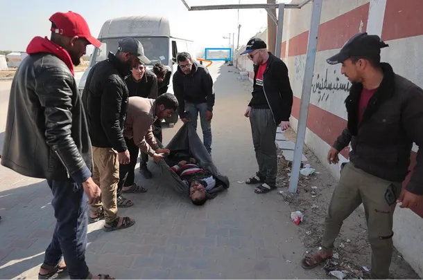
On Tuesday, January 23, during his live stream on Twitch, Baptiste Robert/@fs0c131y challenged viewers to geolocate a photo from an article published in Le Monde's digital edition.
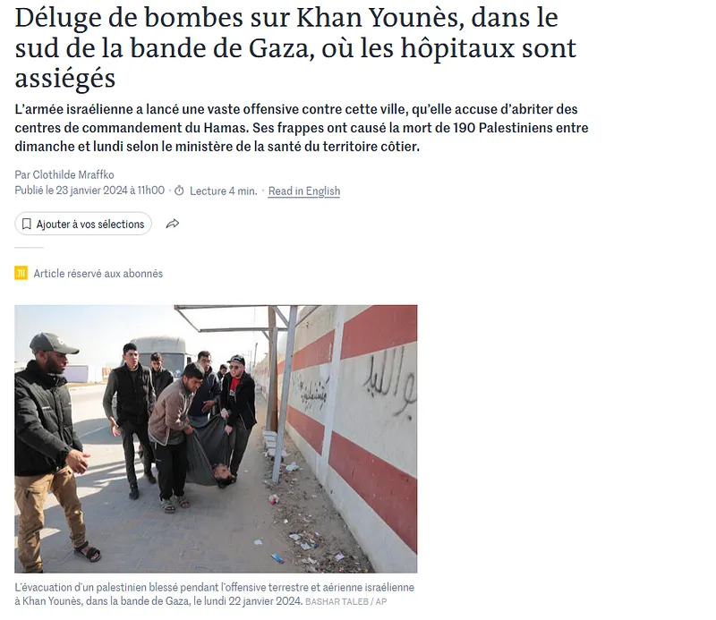
Two of us on the Predicta Lab team took on this geolocation exercise, and in this article we'll walk through how each of us worked to reach a conclusive result.
Warning: some images in this article may be disturbing to readers.
Geolocation by @PunioOsint
Working on the assumption that most of the relevant content available online would come from posts by Khan Younis residents rather than traditional media, @PunioOsint started by focusing on Facebook posts referencing Khan Younis.
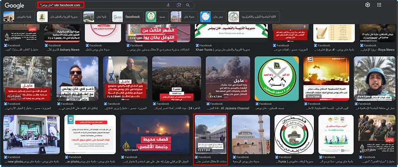
In Google Images, he found the thumbnail of a video posted on Al Jazeera Egypt's Facebook account showing the same wall pattern as the target image. This let him identify several notable features, and the comments revealed that the video had been filmed near Al-Aqsa University.
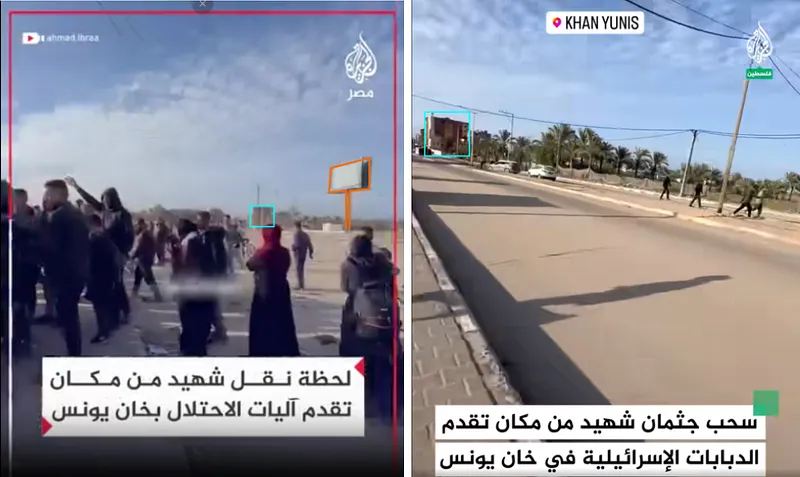
Among these notable features is a square near the shooting location with a billboard installed on it (in orange). In the background of the image, a building appears to have a tower attached to it (in blue). These elements served as landmarks that would later help confirm the location of the red and white wall.
@PunioOsint then carried out a second search of Facebook posts focused on Al-Aqsa University.
In this second Facebook video posted on Al Jazeera Egypt's account, you can see the entrance arch of Al-Aqsa University and how close it is to the street with the red and white wall pattern.
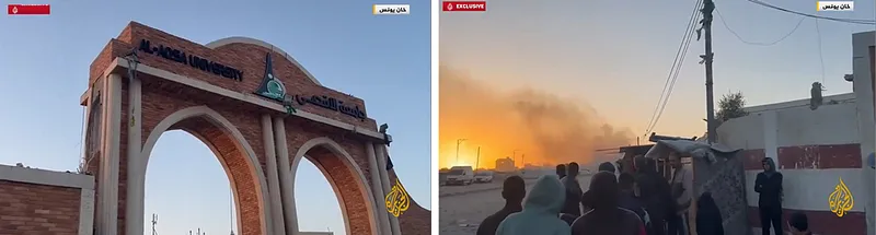
@PunioOsint then searched for Al-Aqsa University on Google Earth, ruled out the university campuses located in downtown Khan Younis since they didn't fit with the palm groves visible in the first video, and found a match between the entrance arch and the north entrance of the applied sciences campus.
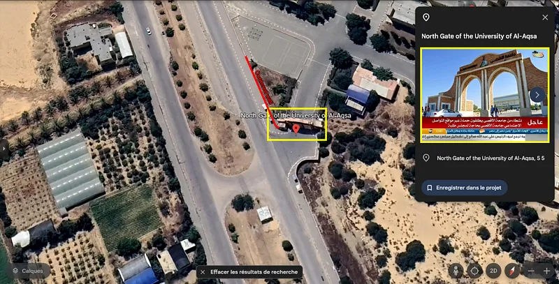
From there, all that remained was to confirm on Google Earth that the notable features he had gathered matched the satellite observations.
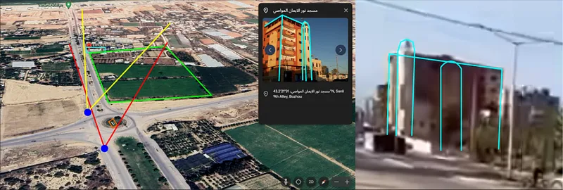
By combining dorking, GEOINT and SOCMINT methods, @PunioOsint managed to determine the geographic area where the target photo had been taken.
The second part of this article covers a different path that leads to the precise coordinates of the shot.
Unlike @PunioOsint, I hadn't seen Baptiste Robert's live stream, so I started from the image alone. I first tracked down the source of the image using reverse image search and found an article from Wear TV. The photo credit tells us it was taken by Bashar Taleb during the evacuation of Khan Younis on Monday, January 22, 2024.
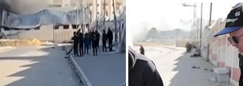
I then searched for accounts linked to Bashar Taleb and found his Instagram and Facebook accounts. On the latter, there's a photo taken at the same spot as our target photo, just seconds apart. It offers a clearer view of the street, showing a damaged building (in blue) and a slight bend to the left at the end of the street (in orange).
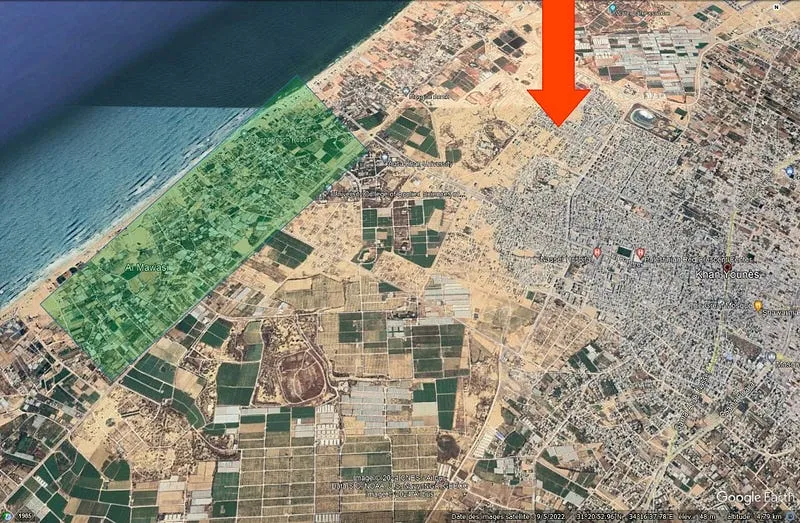
At the same time, I looked into recent news about the city of Khan Younis. In doing so, I learned that on the day the photo was taken, the city was under attack from the northwest (red arrow) by the Israel Defense Forces, and that a safe zone existed nearby in the city of Al Mawasi (green area). It's therefore likely that the person being carried had been injured in the city under attack and was being taken to the safe zone. The photo would then have been taken somewhere between these two points.
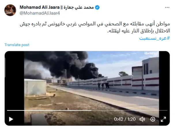
Looking for content posted on social media, I searched Twitter for posts mentioning Khan Younis and Al Mawasi, targeting content posted after January 22, 2024 (خان يونس المواصي since:2024–01–22), and found this Tweet featuring a video showing a wall pattern similar to the one in the target image.
Since the ITV News logo appeared in the top right corner of the image, I then visited their site to access a more complete video. It contains several notable features, including a building whose distinctive deformations (at 1:56) confirm that the video was filmed at the same location as the target photo.
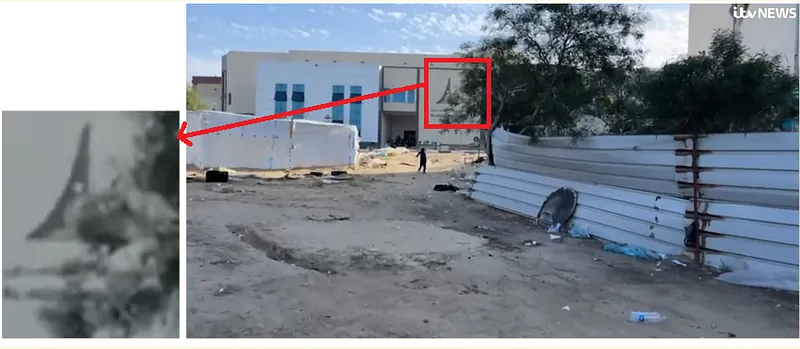
You can also see the crowd leaving the street where the photo was taken, exiting to the left (at 3:04) through a small gate and arriving in front of a building with a distinctive logo.
In the background of the image, you can make out (at 3:51) a square or roundabout (in orange) with a large billboard installed on it (in blue).
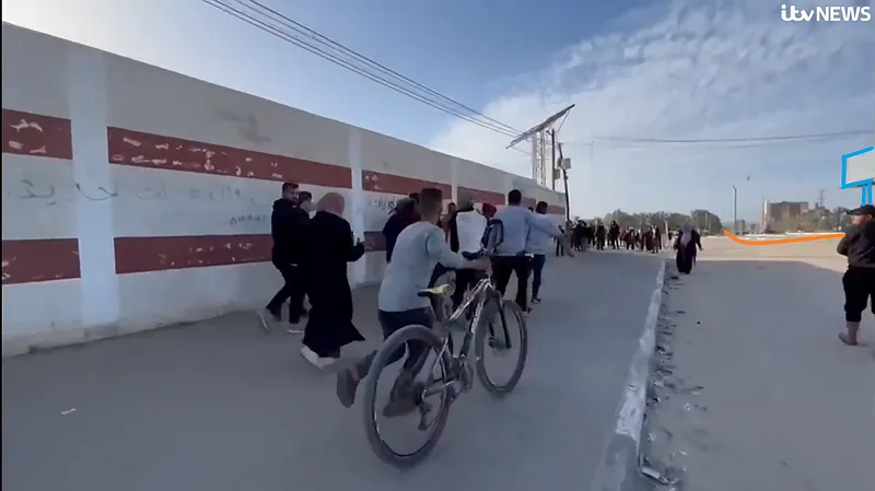
In the geographic area identified earlier, I searched Google Maps for buildings that might carry a similar logo and found Al-Aqsa University, which has an applied sciences campus there.
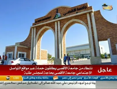
I then searched for photos associated with Al-Aqsa University on Google Maps, which allowed me to confirm the precise location of the courtyard visible in the video (at 3:24).
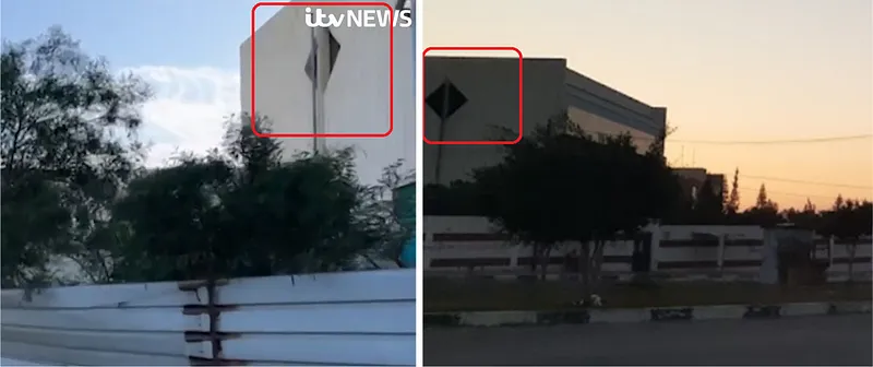
Finally, to pin down the precise location of the shot, I went back to one of the notable features of the target photo: the bus shelter next to a wooden post. This is also visible (at 3:00) in the ITV News video (in green), allowing us to place it precisely on Google Earth.
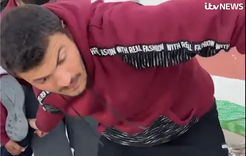
We can therefore confirm that all our elements are consistent with the satellite observations, and state that the location of the shot is at coordinates (31.35761470167857, 34.277377383970055).
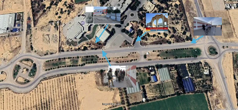
These two different approaches let us highlight what the two methods have in common:
-Cross-referencing the most notable elements gathered from a range of sources (social media, press, institutional media.)
— The importance of factoring in the contextual elements around the image to formulate working hypotheses.
-Testing these hypotheses against observable elements.
Since methodology is at the heart of OSINT research, any writeup that upholds this standard of methodological rigor is an opportunity to discover new reasoning, tools and data sources.
If you enjoyed this article, find more OSINT content on:
predictasearch.com: Find every account linked to an email address or phone number
dorkgpt.com: Generate your Google Dorks with the help of artificial intelligence
predictalab.fr: Discover our full range of products and services
https://www.twitch.tv/fs0c131yoff: The Twitch live stream dedicated to OSINT by Baptiste Robert/@fs0c131y
Don't miss our future newsletters !
Get the latest OSINT news, monthly recaps and product updates in your inbox.
More articles from Predicta Lab
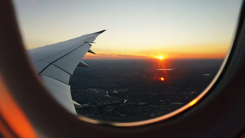
February 6, 2024 · 2 min read
GEOINT: finding a picture taken from a plane
On February 4th, @fs0c131y shared an OSINT quizz inviting his followers to find where a picture taken from a plane was shot. Here’s a resolution found and written by Eric B., edited by Predicta Lab.
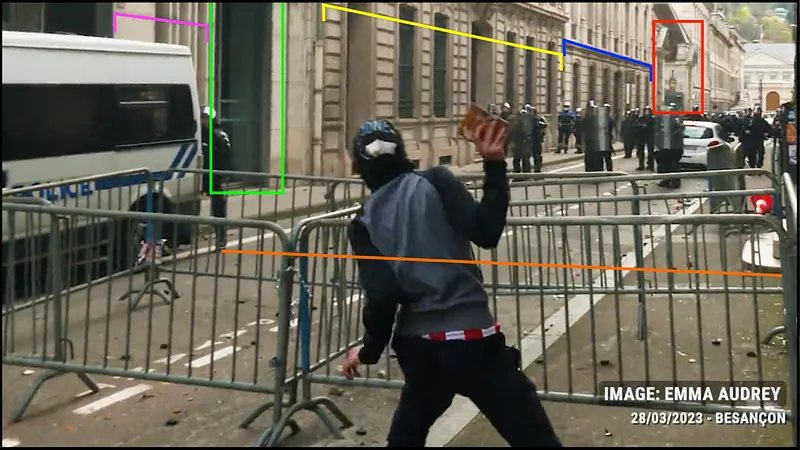
March 31, 2023 · 6 min read
GEOINT: Measuring the Distance of an LBD Shot
A video from the March 28 protests shows a defense ball launcher (LBD) round being fired at a protester: we use OSINT to check whether the firing distance was less than the 10 meters recommended for LBD 40 shots.
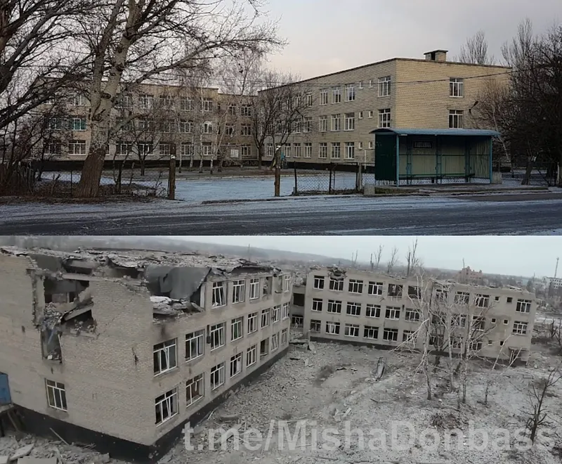
January 25, 2023 · 6 min read
GEOINT: Documenting destruction in Donbas
Finding the locations shown in a drone video of Marinka in Donbas and reconstituting the route taken by the drone, to document the destruction caused by the Russian invasion of Ukraine.
January 17, 2023 · 3 min read
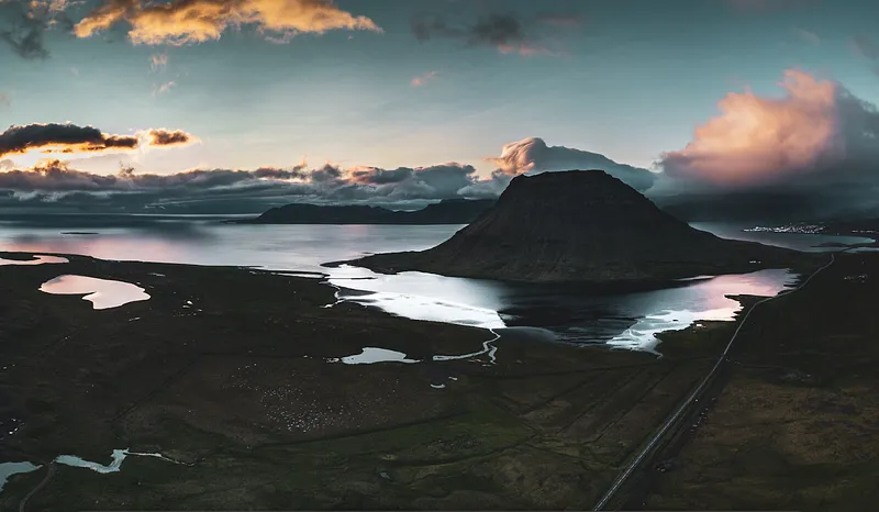
GEOINT: Geolocation using topography
This year, the transition found me staring at my screen saver for maybe a bit too long when I decided to make the most of it by geolocating the beautiful picture it was showing. So here's the challenge: geolocating my screen-saver without reverse image search!
