
GEOINT: finding a picture taken from a plane
February 6, 2024 · 2 min read
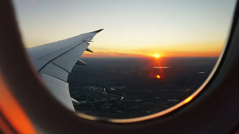
On February 4th, @fs0c131y shared an OSINT quizz inviting his followers to solve it. Here’s a resolution found and written by Eric B., edited by Predicta Lab.
To find where this picture was taken, we need to first find where it was first shared. Google Lens gives hundreds of results for this picture but looking at the ones with the largest size gives us the original and another early publication on Wikimedia.
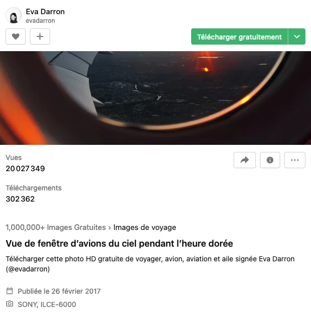
Here we find the author (Eva Darron) and when the picture was taken (August 23rd, 2016 at 6:44 p.m).
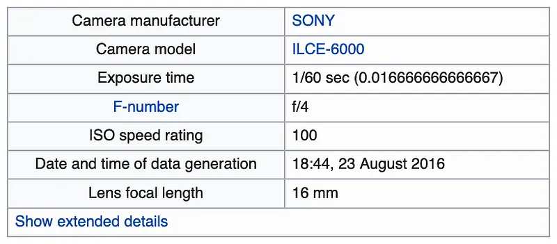
The author’s LinkedIn profile informs us that she was in the New-York City area at that time. Seeing as she worked there, it is likely she travelled around that area and that the picture was taken there.

Hence we’re looking for a picture taken from a plane in August 2016 at 6:44 p.m. in the Greater New York City Area.
Because the picture is rather close to the ground, we can assume that it was taken close to landing or take off and search around local airports.
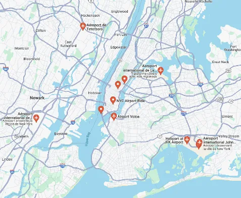
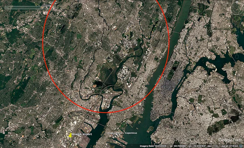
There are several results but Newark Liberty international airport seems to be the closest airports to rivers with similar winding shapes to the river we see in the picture (in blue). We will also be searching for two lakes (in yellow) to the West of the location (direction where the sun sets).
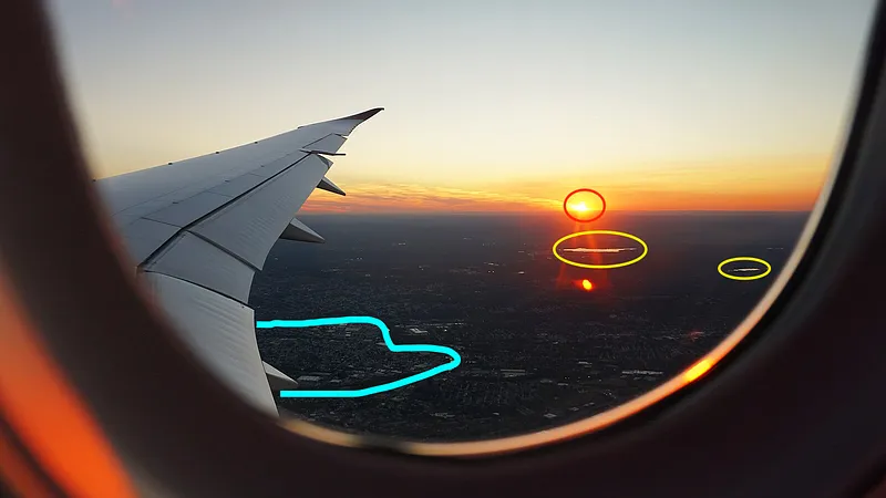
Let’s have a look at the rivers in the following area :
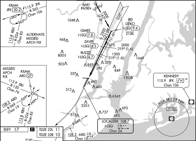
To help us narrow it down we can have a look at Newark airport’s landing patterns for aircrafts coming southward on Skyvector and search along the landing line.
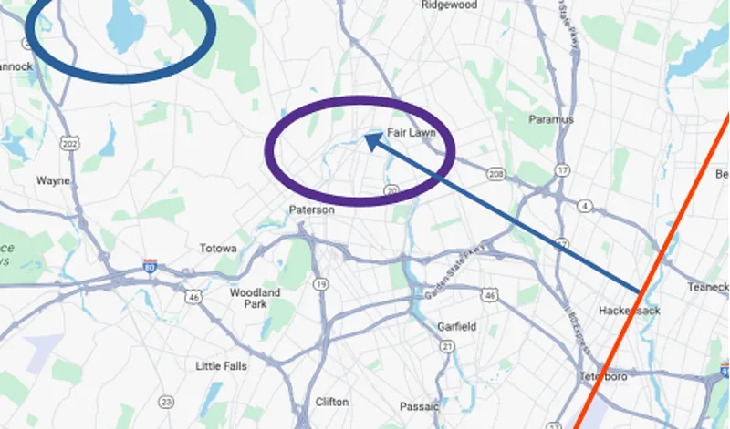
A bit of search on Google Maps leads us to a view close to the picture around Fair Lawn : from the red line representing the plane’s trajectory, we find the curved river in the purple circle as well as the lake in the background in the blue circle.
Now to Google Earth to confirm!
We use the historical imagery function to look at satellite images dating back to 2016, just like our picture.
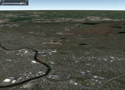
This confirms our geolocation at coordinates close to the followings:
Don't miss our future newsletters !
Get the latest OSINT news, monthly recaps and product updates in your inbox.
More articles from Predicta Lab
January 29, 2024 · 5 min read
GEOINT: Geolocation in the Gaza Strip
Two members of the Predicta Lab team each tried their hand at geolocating a photo of the Khan Younis evacuation taken from a Le Monde article: here's how each of them worked to reach a conclusive result.
March 31, 2023 · 6 min read
GEOINT: Measuring the Distance of an LBD Shot
A video from the March 28 protests shows a defense ball launcher (LBD) round being fired at a protester: we use OSINT to check whether the firing distance was less than the 10 meters recommended for LBD 40 shots.
January 25, 2023 · 6 min read
GEOINT: Documenting destruction in Donbas
Finding the locations shown in a drone video of Marinka in Donbas and reconstituting the route taken by the drone, to document the destruction caused by the Russian invasion of Ukraine.
January 17, 2023 · 3 min read
GEOINT: Geolocation using topography
This year, the transition found me staring at my screen saver for maybe a bit too long when I decided to make the most of it by geolocating the beautiful picture it was showing. So here's the challenge: geolocating my screen-saver without reverse image search!
